
Mimirly Rover.
The Commander's
physical presence in the field.
The Mimirly Rover is a configurable ground robotics endpoint for the Mimirly Commander — a working blueprint that shows how the coordination layer reaches down to real hardware. The reference chassis is built on the Waveshare UGV Beast platform with NVIDIA Jetson Orin compute and a 360° pan-tilt sensing head. It is not a competitor to the wheeled or tracked platforms operators already run. It is a way to prove the loop end-to-end, and a starting point for teams that don't yet have a ground unit of their own.
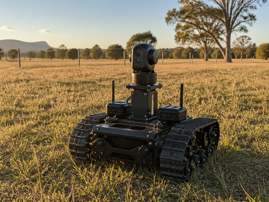
Built on the Waveshare UGV Beast.
The prototype chassis is a real platform we can point at a paddock or a site tomorrow. These are the hardware choices that make it useful as a reference, not just a marketing render.
NVIDIA Jetson Orin compute at the edge. Runs perception, planning and the Commander endpoint adapter on the same module.
Separate motor and payload controllers. Motion keeps running even if the payload controller is rebooting or loading a new model.
A continuously rotating head that can point sensors in any direction without the chassis needing to turn.
Entry configuration keeps the same software contract and control interface at a lower compute budget.
One chassis. Interchangeable payloads.
The Rover is deliberately boring underneath — a rugged tracked base with power, compute and a mounting deck. Everything interesting bolts on top, and the Commander decides what runs and when.
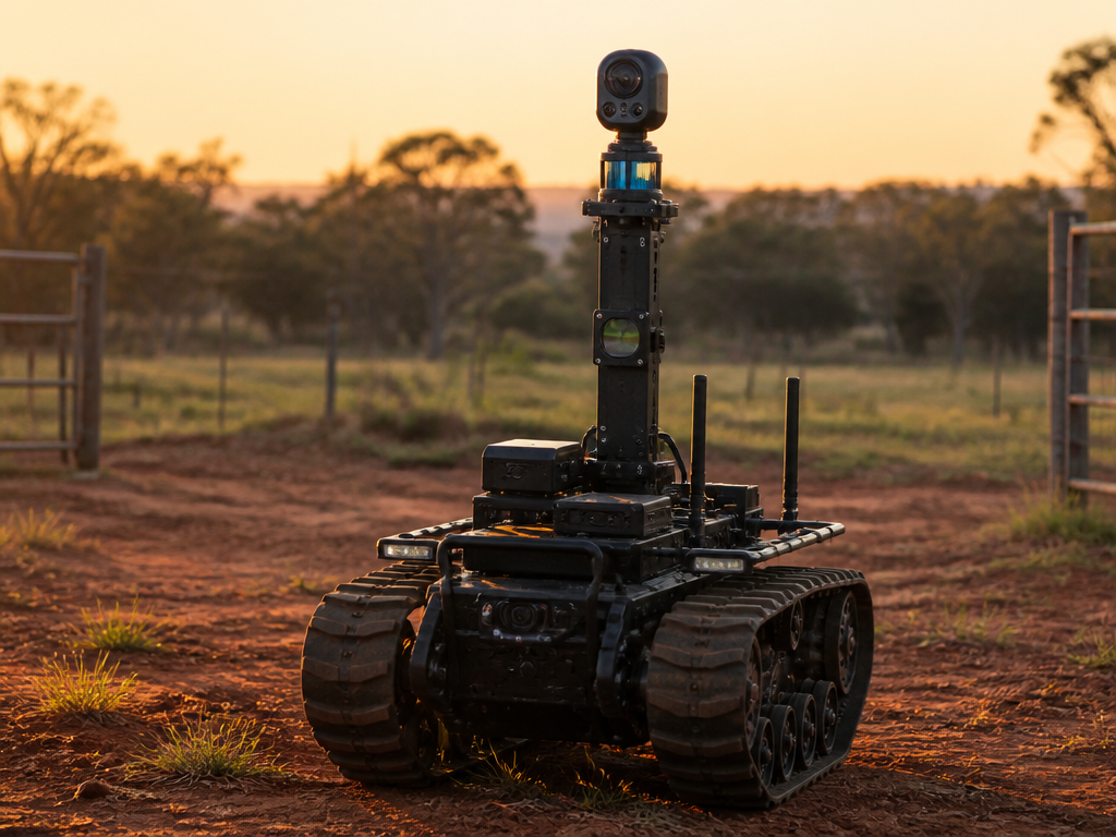
A mast that carries whatever the site needs to see. RGB and thermal for stock and fire watch, LiDAR for stockpile geometry, gas sensors for confined pit work.
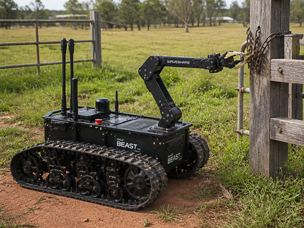
Open a gate. Pick up a marker. Place a sample tube. The point is not dexterity for its own sake — it is closing the last metre of an action the Commander has already decided on.
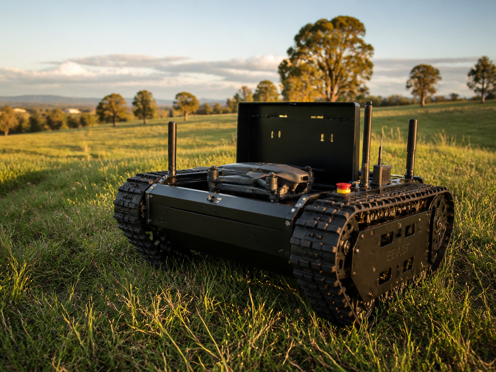
Carry a commercial quadcopter to the edge of a paddock, a pit rim or a job site, then release it for the survey the Commander scheduled. Recover, charge, move on.
Observe. Decide. Act. Verify — with a body attached.
The Commander runs the same loop it runs across drones, sensors and telemetry. The Rover is what closes the "Act" step when the site needs a physical presence instead of another dashboard.
The Rover streams camera, thermal, LiDAR and sensor data back to the Commander alongside every other feed on the site — drones, fences, telemetry.
The Commander weighs the Rover's data with everything else and ranks the next actions. The Rover is one input among many, not a special case.
When a decision needs a physical hand on the ground, the Commander dispatches the Rover — drive to a waypoint, launch a drone, open a gate, place a probe.
The Rover confirms what happened, captures evidence, and the result feeds back into the next cycle. No blind executions.
Same chassis. Different ground.
The Rover exists to prove the coordination layer holds up in the places operators actually work. These are the environments the reference design is aimed at first.
- Farms
Paddock checks after rain. Trough and fence inspection on a schedule the Commander sets. Launch a drone from a paddock corner instead of a shed.
- Mining
Continuous pit-rim presence. Stockpile scans on demand. Gas and dust readings in areas that are marginal for a person on foot.
- Construction
Overnight and weekend site presence. Progress capture after a pour. Safety walks that don't wait for someone to be free to do them.
- Solar
Row-by-row thermal inspection across large arrays. Vegetation checks under panels. Faults flagged in the same queue as every other action.
- Utilities
Substation perimeter and asset checks. Corridor patrols for pipelines and transmission lines. Evidence captured against a work order, not a folder.
What can bolt onto the deck.
These are the payloads the reference design is built to accept. Operators will mix and match based on the site — and the Commander treats each one as an addressable capability, not a fixed feature.
- RGB + thermal headStock, fire, people, heat signatures on panels or plant.
- LiDAR scannerStockpile volumes, earthworks, as-built capture.
- Gas & environmentalCH4, CO, dust, noise, temperature and humidity.
- Manipulator armGate latches, sample tubes, marker placement, small pickups.
- Drone launch deckCarry, launch, recover and charge a commercial quadcopter.
- Comms relayExtend LTE, mesh or satellite coverage to the working face.
An endpoint, not an island.
The Rover is designed against the same endpoint contract the Commander uses for drones, sensors and telemetry. That is the point: what works for the Rover also works for the rover an operator already owns.
The coordination layer. Runs the Observe → Decide → Act → Verify loop across every connected endpoint on a site.
A thin, standard interface. Any rover — the reference Rover, an operator's existing platform, or a third-party unit — talks to the Commander through the same contract.
Navigation, safety envelope, payload control and local buffering. Enough autonomy to be useful when the link is bad, not so much that it drifts from the plan.
Power, data and mounting standard on the deck. Payloads are discoverable — plug in a LiDAR head and the Commander knows the capability is now on the site.
Honest about where it is.
The Rover is early. This is the current shape of the work, in the order it is happening.
- 01NowReference chassis in the workshop.
Tracked base, power and compute, mounting deck. First payloads: RGB + thermal head, and a drone launch bay.
- 02NextFirst field deployment.
One farm, one construction site, one pit-adjacent trial. Coordinated by the Commander alongside a drone and existing telemetry.
- 03AfterSecond payload set.
Manipulator arm, LiDAR head, gas sensing. Endpoint contract published for third-party rovers to speak the same protocol.
- 04LaterReference, not roadmap.
The Rover stays a reference design. If operators want to build or buy against it, the specification is open. Mimirly stays a software company.
Bring your own rover, or start with ours.
If your operation already runs a ground platform, we want it on the endpoint contract. If it doesn't, the reference Rover is a way to prove the loop on your site without a hardware project of your own.